7 Essential Skills for Navigating Lakes Safely From Beginner to Pro
Master lake navigation with 7 essential skills: map reading, weather recognition, anchoring, depth awareness, emergency protocols, boat handling & night navigation.
Why it matters: Lake navigation accidents claim hundreds of lives annually with most incidents stemming from preventable mistakes and inadequate preparation.
The big picture: Whether you’re kayaking on a mountain lake or sailing across vast waters you need specific skills that differ significantly from ocean or river navigation.
What’s ahead: Mastering these seven fundamental techniques will transform you from a cautious beginner into a confident lake navigator who can handle changing conditions and unexpected challenges.
Disclosure: As an Amazon Associate, this site earns from qualifying purchases. Thank you!
Master Map Reading and Compass Navigation
Every experienced lake navigator carries two essential tools that never need batteries or satellite signals. These traditional navigation methods remain your most reliable backup when technology fails.
Understanding Topographic Maps of Lake Areas
Learn essential map reading and navigation skills with this U.S. Army guide. Designed and tested for durability, it provides reliable information for any environment.

Topographic maps reveal underwater hazards that GPS can’t show you. You’ll spot shallow areas, submerged rocks, and sudden depth changes through contour lines that indicate bottom terrain.
Study the contour intervals before launching – tight lines mean steep drop-offs while widely spaced lines indicate gradual slopes perfect for anchoring.
Using a Marine Compass for Accurate Bearings
Marine compasses provide precise directional readings that remain accurate regardless of weather conditions. You’ll need to account for magnetic declination in your area, which varies from true north by several degrees.
Take bearing readings to multiple landmarks before departing, then use back-bearings during your return trip to maintain your intended course.
Identifying Landmarks and Reference Points
Prominent shoreline features serve as your primary navigation references throughout your lake journey. You’ll want to identify distinctive trees, buildings, or rock formations that remain visible from various distances and angles.
Choose landmarks at different elevations since low-lying features disappear as you move farther from shore, while elevated points stay visible for miles.
Develop Weather Pattern Recognition Skills
Weather changes rapidly on lakes, and you’ll need to read atmospheric conditions like a book to stay safe on the water.
Reading Cloud Formations and Wind Changes
Cumulus clouds building vertically signal potential thunderstorms within hours. Watch for wind shifts that create choppy water patterns – these often precede weather fronts by 30-60 minutes.
Wind direction changes combined with temperature drops indicate approaching weather systems that can turn calm waters dangerous quickly.
Understanding Local Lake Weather Conditions
Large lakes create their own microclimates with unique wind patterns and temperature variations. Morning fog typically burns off by 10 AM, but afternoon thermal winds can reach 15-20 mph unexpectedly.
Study your specific lake’s seasonal patterns – some experience predictable afternoon storms while others see sudden evening squalls during summer months.
Recognizing Storm Warning Signs
Dark clouds building on the horizon move faster over water than land, often arriving 15-20 minutes sooner than expected. Lightning visible in the distance means you’re already within the storm’s 10-mile danger zone.
Sudden temperature drops of 10+ degrees, combined with increasing wind gusts, give you roughly 10-15 minutes to reach shore safely before conditions deteriorate.
Learn Proper Anchoring and Mooring Techniques
Your anchoring skills directly determine whether you’ll drift into hazards or maintain a secure position during changing lake conditions. Proper technique protects both your vessel and other boaters sharing the water.
Selecting Appropriate Anchor Types for Lake Bottoms
Fluke anchors work best in sandy or muddy lake bottoms because their sharp edges dig deep for maximum holding power. Rocky or weed-covered bottoms require grapnel anchors with multiple tines that grab irregular surfaces. Mushroom anchors excel in soft clay bottoms but struggle in hard-packed sand or rocky areas.
This galvanized steel anchor provides reliable holding power in various seafloor conditions. Its wide flukes and optimized weight-to-holding ratio make it ideal for boats 25-30 feet.

Understanding Anchor-to-Boat Length Ratios
Deploy anchor line at 5:1 to 7:1 ratios for secure holding in most lake conditions. A 20-foot depth requires 100-140 feet of line to create the proper angle. Shorter ratios cause vertical pull that breaks anchor grip, while excessive line wastes space and creates drift hazards.
Securing Your Vessel in Various Wind Conditions
Secure additional anchor points when winds exceed 15 mph to prevent your boat from swinging into other vessels or shoreline obstacles. Use bow and stern anchors in strong crosswinds to maintain position. Deploy sea anchors or drogues during sudden squalls to reduce drift speed and maintain directional control.
Understand Lake Depth and Underwater Hazards
Lake depth knowledge separates confident navigators from those who scrape hulls and damage props. Understanding what lies beneath the surface becomes your sixth essential skill for safe lake navigation.
Reading Depth Charts and Sonar Equipment
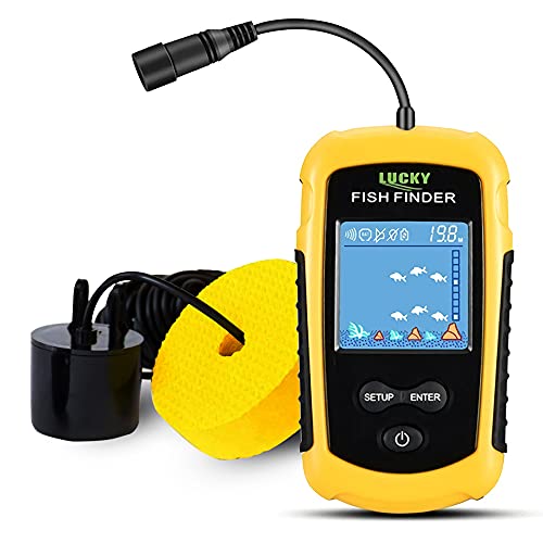
Locate fish and determine water depth with this portable fish finder. Its sonar transducer detects fish location, depth (3ft-328ft), and bottom terrain, displaying data clearly on a backlit LCD screen.
Depth charts reveal underwater topography that GPS can’t show you. Modern fish finders and sonar units display real-time depth readings while revealing bottom composition and structure.
Study contour lines on nautical charts before launching—they’ll show you drop-offs, shallow areas, and underwater ridges. Set your depth alarm to sound when water becomes dangerously shallow for your vessel’s draft.
Identifying Submerged Rocks and Debris
Submerged obstacles cause expensive damage and dangerous situations. Look for surface disturbances like ripples, color changes, or unusual wave patterns that indicate underwater hazards.
Dead trees, construction debris, and rock formations often hide just below the surface. Local knowledge proves invaluable—talk to marina staff and experienced boaters about known hazard locations in your target lake.
Recognizing Shallow Water Warning Signs
Water color changes from deep blue to light green or brown as depth decreases. Vegetation growth, bird activity, and surface debris often concentrate in shallow areas.
Watch for standing waves or choppy water in otherwise calm conditions—these patterns frequently indicate shallow shoals or underwater obstructions. Reduce speed immediately when you notice these warning signs.
Practice Emergency Response and Safety Protocols
Real emergencies on lakes happen fast and leave little room for hesitation. Your ability to execute proven emergency procedures can mean the difference between a manageable incident and a tragedy.
Executing Man Overboard Procedures
Turn immediately toward the person in the water using a wide circle approach. This technique keeps your propeller away from the victim while maintaining visual contact. Throw a flotation device as soon as possible and assign one crew member to point continuously at the person overboard. Practice the “reach, throw, row, go” sequence regularly so muscle memory takes over during actual emergencies.
Operating Emergency Communication Equipment
Test your VHF radio and emergency beacon monthly to ensure they’ll work when needed. Channel 16 remains the universal distress frequency, but you’ll need to know how to switch between channels for Coast Guard coordination. Keep emergency contact numbers programmed in waterproof cases and understand the difference between urgency calls (“Pan-Pan”) and distress calls (“Mayday”) to communicate appropriate response levels.
Implementing First Aid in Marine Environments
Hypothermia and drowning complications require modified first aid techniques on the water. Standard CPR works differently on unstable boat decks, so practice chest compressions while kneeling with proper body mechanics. Keep first aid supplies in waterproof containers and learn to stabilize spinal injuries before attempting rescue moves. Cold water dramatically extends survival times, but also complicates treatment protocols for unconscious victims.
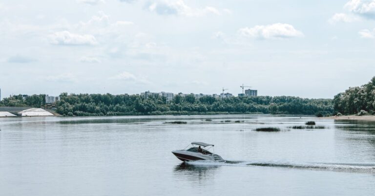
Master Boat Handling in Confined Waters
Confined water navigation demands precision and patience that open water simply doesn’t require. You’ll face tighter turning radii, reduced visibility, and less room for error correction.
Navigating Narrow Channels and Inlets
Navigate channels by maintaining center position and reducing speed to half your normal cruising pace. Study channel markers beforehand and identify the deepest water path using your depth finder. Keep your wake minimal to avoid shoreline erosion and maintain better boat control in tight spaces.
Controlling Speed in No-Wake Zones
Control your speed by throttling down to displacement speed where your boat moves through water rather than planing on top. You’ll know you’re at proper no-wake speed when your bow drops and stern wake disappears completely. Most boats achieve this at 1000-1500 RPM depending on engine size.
Maneuvering Around Other Watercraft
Maneuver around other boats by maintaining at least 100 feet of clearance and signaling your intentions early with horn blasts. Pass on the port side when possible and avoid crossing directly behind other vessels where propeller wash creates hazardous conditions. Reduce speed when passing anchored boats to prevent your wake from dragging their anchor.
Develop Night Navigation Capabilities
Darkness transforms familiar lake environments into challenging navigation puzzles where mistakes can quickly become dangerous. You’ll need specialized skills and equipment to maintain safe passage when visibility drops to near zero.
Understanding Navigation Light Systems
Navigation lights communicate vessel type, direction, and size to other boaters in darkness. You must recognize red port lights, green starboard lights, and white stern lights to determine approaching vessel direction and size.
Memorize the phrase “red right returning” for navigating marked channels at night. Study light patterns for different vessel types including sailboats under sail, fishing boats, and commercial traffic that frequent your lake.
Using GPS and Electronic Chart Plotters
Navigate confidently with the Simrad Cruise 5-inch GPS chartplotter. Preloaded with US Coastal C-MAP charts and an 83/200 transducer, it offers simple GPS navigation and automatic depth tracking right out of the box.

Electronic navigation becomes your primary tool when visual references disappear in darkness. Set waypoints during daylight hours for safe return routes and mark hazardous areas with electronic boundaries.
Configure night mode displays with red backlighting to preserve your natural night vision. Create backup routes in your GPS and always carry portable backup units with fully charged batteries for redundancy.
Maintaining Proper Lookout Procedures
Proper lookout requires rotating between electronic displays and visual scanning to detect unlit hazards. Assign dedicated lookout duties to crew members and establish communication protocols for reporting sightings.
Use your peripheral vision and brief glances rather than staring directly at objects in darkness. Listen for engine sounds, voices, or unusual water disturbances that indicate nearby vessels or hazards your eyes might miss.
Conclusion
Mastering these seven essential skills transforms you from a novice into a confident lake navigator. Each technique builds upon the others creating a comprehensive safety foundation that protects you and your passengers in any situation.
Your investment in learning proper navigation fundamentals weather recognition and emergency protocols pays dividends every time you’re on the water. The combination of traditional skills like compass reading with modern technology like GPS creates redundancy that keeps you safe when conditions deteriorate.
Remember that becoming proficient takes practice in various conditions. Start with calm days to build your confidence then gradually challenge yourself as your skills develop. Your commitment to safety preparation ensures countless enjoyable adventures on the water ahead.
Frequently Asked Questions
What makes lake navigation different from ocean or river navigation?
Lake navigation requires distinct skills due to confined waters, varying depths, and unique weather patterns. Unlike oceans with predictable tides or rivers with current flow, lakes present challenges like sudden weather changes, hidden underwater hazards, and limited maneuvering space that demand specialized techniques and heightened awareness.
Why are traditional navigation tools still important when GPS is available?
Traditional tools like topographic maps and marine compasses reveal critical information GPS cannot provide, such as underwater hazards and accurate directional readings during electronic failures. Maps show depth contours and submerged obstacles, while compasses work independently of batteries or satellite signals, ensuring reliable navigation backup.
How can I recognize dangerous weather conditions on a lake?
Watch for dark cloud formations, sudden wind direction changes, and rapid temperature drops that signal approaching storms. Learn local weather patterns specific to your lake, as conditions can change quickly in confined water bodies. Set up weather alerts and always check forecasts before departure.
What’s the proper anchor-to-boat length ratio for lake anchoring?
Use a 7:1 ratio in normal conditions (seven feet of anchor line for every foot of water depth) and increase to 10:1 in rough weather. Select anchor types based on lake bottom composition – fluke anchors for sand, plow anchors for mud, and grapple anchors for rocky bottoms.
How do I identify underwater hazards while navigating?
Study depth charts and contour lines on nautical charts, use sonar equipment to scan underwater topography, and set depth alarms for shallow areas. Watch for surface disturbances, changes in water color, and unusual wave patterns that indicate submerged rocks or debris beneath the surface.
What should I do in a man overboard emergency?
Immediately throw a flotation device toward the person, assign someone to maintain visual contact, and execute a quick stop turn to return to their position. Practice recovery techniques regularly, ensure all crew members know emergency procedures, and maintain emergency communication equipment in working order.
How do I navigate safely at night on a lake?
Learn navigation light systems – red port lights and green starboard lights indicate vessel direction and size. Use GPS with night mode displays, set waypoints during daylight, and maintain proper lookout procedures by rotating between electronic displays and visual scanning to detect unlit hazards.
What are the key techniques for navigating narrow lake channels?
Maintain center position in the channel, reduce speed significantly, and stay alert for shallow areas marked by buoys or depth changes. Follow the “red right returning” rule when entering harbors, and use electronic charts to identify channel boundaries and safe passage routes.
How should I handle boat traffic in confined lake waters?
Maintain safe clearance distances, clearly signal your intentions, and reduce speed when passing anchored boats. Follow right-of-way rules, communicate via VHF radio when necessary, and be extra cautious in no-wake zones where reduced visibility and multiple vessels create challenging conditions.