7 Best Tide Charts For Kiteboarding To Plan Your Session
Master the waves with our top 7 tide charts for kiteboarding. Learn how precise water-level data helps you plan the perfect session and stay safe on the water.
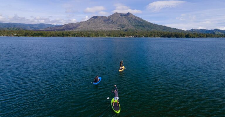
There is nothing more frustrating than arriving at your favorite kite spot only to find the water has completely vanished or the launch area is submerged by a high tide. Mastering the rhythm of the ocean is the secret weapon of every seasoned kiteboarder looking to maximize their time on the water. By syncing your session with the right tide data, you turn a potential wash-out into an epic day of riding.
Disclosure: As an Amazon Associate, this site earns from qualifying purchases. Thank you!
Understanding Tide Dynamics for Kiteboarding
Tides are essentially the periodic rise and fall of sea levels caused by the gravitational forces of the moon and the sun. For a kiteboarder, these shifts dictate more than just water depth; they change the very shape of your playground. A spot that offers butter-flat water at mid-tide might turn into a chaotic, choppy mess at high tide, or disappear entirely into a rocky shoreline.
Beyond depth, tides influence current speed and direction. An outgoing tide, or "ebb," often creates a powerful current that can pull you away from your launch point, while an incoming "flood" tide can push you toward obstacles. Understanding how these water movements interact with local wind direction is essential for planning a safe and productive session.
Why Accurate Tide Data Matters for Riders
Accurate data is the difference between a successful session and a dangerous one. Many kiteboarding locations have specific "tide windows" where the water is deep enough to prevent fin strikes on shallow reefs or sandbars. If you miscalculate, you aren’t just risking your gear; you are risking your physical safety by potentially landing in hazardous, shallow terrain.
Furthermore, tide levels directly impact the size and accessibility of your launch and landing zone. At some spots, high tide can completely swallow the beach, leaving you with nowhere to safely rig your kite or launch your lines. Relying on precise, localized data ensures you arrive when the beach is wide, the water is deep, and the conditions are optimized for your skill level.
Windguru: Best for Integrated Wind and Tide
If you are the type of rider who prefers a single dashboard for all your decision-making, Windguru is your go-to tool. It excels by layering tide information directly alongside wind speed, direction, and gust forecasts. This integration allows you to instantly see if the incoming tide will align with the best wind windows for your specific beach.
I recommend Windguru for riders who value efficiency and want to avoid toggling between multiple apps. While the interface is utilitarian and takes a bit of time to master, the depth of data is unmatched for serious kiters. If you want a one-stop shop that correlates environmental variables with precision, this is the tool for you.
Tides Near Me: Best Mobile App for Precision
When you need a quick, no-nonsense answer about when the water will peak, Tides Near Me is the industry standard. It focuses exclusively on tide and current data, providing a clean, easy-to-read graph that shows exactly where you are in the tide cycle. It is incredibly reliable for those who just want to know the "when" without the extra noise of swell charts or wind models.
This app is perfect for the rider who already has a favorite weather app but needs a secondary, dedicated source for water levels. It is lightweight, fast, and works seamlessly in areas with poor cellular reception. If you prioritize simplicity and accuracy above all else, this is the essential app to keep on your home screen.
Surfline: Best for Real-Time Coastal Reports
Surfline is widely known for its surf cams, but it is an incredibly powerful tool for kiteboarders as well. The real-time visual confirmation of the beach—seeing exactly how much sand is left at high tide—is invaluable. You can watch the waves and the water movement live, which helps you judge the current conditions better than any static chart ever could.
This tool is ideal for kiters who ride at popular, crowded beaches where local knowledge is key. While the premium subscription can be pricey, the ability to "see" your spot before you drive is a game-changer. If you are heading to a new or complex break, Surfline is the best investment you can make to ensure you don’t waste a trip.
WillyWeather: Best for Detailed Local Forecasts
WillyWeather is the powerhouse for those who want to drill down into the micro-climate of their local spot. It offers an incredibly granular view of tide heights, sun cycles, and local weather patterns. It’s particularly useful for planning long sessions where you need to track how the tide will change over the course of an entire afternoon.
I suggest this tool for the meticulous planner who likes to analyze every variable before leaving the house. It is excellent for identifying the exact minute of "slack water," where the current pauses between tides, which is often the best time for learning new tricks. If you are a data-driven rider, you will find this app indispensable.
Magicseaweed: Best for Swell and Tide Trends
Magicseaweed is a staple in the water sports community because it excels at visualizing how swell and tide interact. For kiteboarders, knowing how the tide influences wave height and period is vital, especially at spots with reef breaks or sandbars. It provides a long-range outlook that helps you plan your weekend sessions days in advance.
This app is perfect for riders who enjoy wave-riding or strapless freestyle and need to match the tide with the best swell conditions. It provides a clear, color-coded trend that makes it easy to spot the "hero" days of the week. If you need to plan your sessions based on the quality of the water movement, Magicseaweed is your best bet.
NOAA Tides & Currents: Best Official Source
When you need the absolute, undisputed truth about water levels, you go to the source. NOAA provides the raw data that most other apps and websites use to populate their charts. It is the most reliable, scientific, and official tool available, especially for those riding in coastal regions near ports or shipping channels.
NOAA is for the rider who doesn’t trust third-party interpretations and wants to see the raw, unadulterated numbers. While the interface isn’t as polished or user-friendly as a commercial app, the accuracy is second to none. If you are riding in a remote area or a location with complex currents, stick to the NOAA data to stay safe.
Tide Charts Near Me: Best Offline Access Tool
There is nothing worse than being at a remote beach with no signal and no way to check the tide. Tide Charts Near Me is designed for exactly this scenario, offering robust offline capabilities that keep your data accessible when you are off the grid. It is a simple, reliable backup that ensures you are never caught off guard by a changing tide.
This is a must-have for the adventurous kiter who explores hidden spots or travels to remote coastlines. It doesn’t have the bells and whistles of the larger platforms, but it performs one task perfectly: giving you the tide schedule when you need it most. Keep this on your phone as a safety net, and you will never be left guessing.
Planning Your Session With Tide Data Tools
Effective planning starts by cross-referencing your chosen tide tool with your local wind forecast. Always look for the "slack" periods if you are a beginner, as these minimize the current and make water starts much easier. If you are an advanced rider, look for the ebb or flood tides that provide the specific water conditions—like kickers or flat channels—that suit your riding style.
- Check the tide range: Know the difference between your spot’s high and low tide in feet.
- Monitor the current: Use tide data to avoid being pushed into dangerous zones.
- Account for the wind: High winds can sometimes mask or amplify tide effects.
- Always have a backup: Keep two different data sources to verify your information.
Remember that tides are predictable, but weather is not. Use your tide tools to define your window of opportunity, then stay flexible if the wind doesn’t cooperate. By combining these digital tools with a watchful eye on the beach, you will spend more time riding and less time standing on the shore.
Mastering the tide is a fundamental skill that separates casual beachgoers from dedicated kiteboarders who truly know their local spots. By integrating these tools into your pre-session routine, you ensure that every trip to the water is safe, efficient, and perfectly timed. Get to know your local tide patterns, choose the tool that fits your workflow, and enjoy the confidence that comes with being fully prepared for the conditions.