7 Best Fishing Offline Map Apps For Remote Areas Survival
Navigate remote waters with confidence. Discover the 7 best offline fishing map apps designed for survival, ensuring reliable navigation without any signal.
There is nothing quite like the silence of a backcountry lake when you are miles away from the nearest cell tower. However, relying on a paper map in the age of digital navigation can be a gamble when you are trying to pinpoint hidden inlets or remote shorelines. These seven offline mapping tools ensure you stay on the water and off the grid safely.
Disclosure: As an Amazon Associate, this site earns from qualifying purchases. Thank you!
Gaia GPS: Best Offline Maps for Remote Anglers
Gaia GPS is the gold standard for anglers who treat their fishing trips like serious expeditions. Its strength lies in its massive library of map layers, which allow you to overlay public lands, slope angles, and water features onto high-resolution topographic maps. You can download enormous swaths of wilderness for offline use, ensuring that even when the signal drops, your precise location remains visible.
This app is perfect for the angler who enjoys bushwhacking to find untouched alpine lakes. By toggling the "Public Lands" overlay, you can quickly verify where you are legally allowed to cast a line, avoiding accidental trespassing on private property. If you prioritize detailed terrain analysis and reliable offline performance, Gaia GPS is the most robust choice in your arsenal.
OnX Hunt: Precise Property Lines for Fishing
While primarily designed for hunters, OnX Hunt is an absolute game-changer for anglers navigating areas with complex land ownership. Its proprietary data shows clear, color-coded property boundaries, which is invaluable when you are fishing a river that winds through a patchwork of private and public land. Knowing exactly where the public easement ends can save you from an uncomfortable confrontation with a landowner.
The offline functionality is incredibly intuitive, allowing you to save map tiles with just a few taps. Beyond boundaries, the app provides excellent topographical data that helps you identify potential access points or deep holes in a river system. If you fish in regions where private land borders public waterways, OnX Hunt is an essential tool for avoiding legal headaches.
Fishbrain: Social Insights and Map Layers
Fishbrain is unique because it bridges the gap between social networking and practical navigation. While the primary draw is the crowdsourced data on what fish are biting, the premium version offers depth contour maps for thousands of lakes. Seeing the bottom structure of a lake you have never visited before allows you to identify drop-offs and weed lines before you even wet a line.
The offline mode allows you to store these bathymetric maps so you can reference structural data while drifting on a remote reservoir. It is best suited for the angler who wants to combine structural knowledge with community-driven intel. If you are looking for a competitive edge on new water, Fishbrain provides the data to help you fish smarter, not harder.
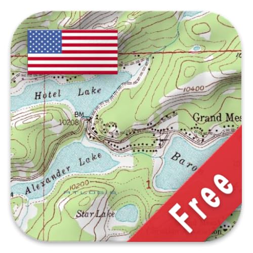
Google Maps: Essential Offline Area Downloads

Many anglers overlook Google Maps, but its offline capabilities are surprisingly effective for basic navigation. By downloading a specific area for offline use, you retain access to road networks and satellite imagery, which is often enough for getting to a remote trailhead or boat ramp. It is the most accessible and user-friendly option for those who don’t want to manage complex layers.
However, keep in mind that Google Maps lacks the specialized topographical detail required for deep backcountry navigation. It is best used as a secondary safety net or for navigating the "last mile" of your drive. If you need a simple, reliable tool to ensure you can find your way back to your vehicle, Google Maps is an indispensable backup.
Avenza Maps: Importing Custom Fishing Charts
Avenza Maps is the professional choice for those who need to use highly specific, georeferenced maps. You can import custom PDFs, such as specialized lake depth charts or Forest Service maps, and use your phone’s GPS to track your position directly on those files. This is ideal for anglers who have access to proprietary or highly detailed local fishing maps that aren’t available on mainstream apps.
The app is incredibly stable and functions entirely without a cellular connection once your maps are loaded. It is best suited for the technical angler who prefers working with specific, high-fidelity maps rather than general-purpose apps. If you have a custom chart that you trust more than any digital overlay, Avenza is the platform you need.
Basemaps: High-Resolution Satellite Imagery
Basemaps focuses on delivering the clearest, most high-resolution satellite imagery available for mobile devices. When you are looking for hidden channels, submerged logs, or potential spawning beds in a remote waterway, the clarity of your satellite view is everything. This app excels at providing a crisp, real-world visual of your surroundings that topographical lines simply cannot match.
The interface is streamlined and built for speed, making it easy to download large areas without bogging down your device. It is a fantastic choice for the visual angler who relies on scouting water conditions from above. If you want to see the world as it actually looks, rather than as a collection of contour lines, Basemaps is your best bet.
AllTrails: Finding Remote Fishing Trailheads
AllTrails is the premier choice for the angler whose fishing trip begins with a significant hike. Its massive database of user-reviewed trails helps you evaluate the difficulty of the trek to a remote stream or lake, complete with recent photos and trail conditions. Knowing if a trail is washed out or overgrown can be the difference between a successful day and a dangerous situation.
The app’s offline maps are excellent for keeping you on the right path during the hike, ensuring you don’t waste energy getting lost before you even reach the water. It is ideal for the hiker-angler who prioritizes the journey to the spot as much as the fishing itself. If your fishing spots are at the end of long, unmarked trails, AllTrails is an essential companion.
Essential Offline Map Features for Survival
When selecting an app for remote survival, look for offline caching, which allows you to download map data while you have service. Ensure the app supports GPS tracking without cell signal, as some apps rely on cellular towers for triangulation. You should also prioritize apps that feature custom waypoints, enabling you to mark your vehicle, your campsite, or a particularly productive fishing hole.
- Topographic contours: Crucial for understanding elevation changes in rough terrain.
- Satellite imagery: Vital for identifying water hazards and vegetation density.
- Offline search: Essential for finding landmarks when you have no data.
- Battery optimization: The ability to run in the background without excessive drain.
Managing Battery Life During Fishing Trips
A dead phone is a useless navigation tool, so managing battery life is a core skill for the remote angler. Always carry a rugged, waterproof power bank to keep your device charged throughout the day. When not actively checking your location, put your phone in Airplane Mode to stop it from constantly searching for a signal, which is the fastest way to drain your battery.
Reduce the screen brightness and close unnecessary background apps to extend your runtime significantly. If you are on a multi-day trip, consider bringing a small, portable solar panel that can be strapped to your pack while you hike. Treat your battery life as a finite resource, just like your water or food supplies.
Safety Protocols for Remote Fishing Spots
Never rely solely on one digital device; always carry a paper map and a compass as a fail-safe. Before heading out, share your trip plan with someone you trust, including your expected route and your return time. If you are fishing near moving water, be aware of changing weather conditions, as a sudden storm can make your return path much more dangerous than the hike in.
- Always carry an emergency whistle and fire starter.
- Keep your phone in a waterproof, floating case.
- Know your limits; turn back before you are exhausted.
- Carry a basic first aid kit tailored to water-related injuries.
Navigating the backcountry requires a blend of modern technology and old-school preparation. By utilizing these offline mapping tools and maintaining strict safety protocols, you can confidently explore the most remote waters. Stay prepared, respect the environment, and enjoy the solitude of your next fishing adventure.