6 Ideas for Finding Kayaking Destinations Locals Keep Secret
Find secret kayaking spots. We share 6 tips for uncovering hidden launches and pristine waters that aren’t in the guidebooks. Paddle like a local.
You’ve paddled the same popular lake circuit three weekends in a row, sharing the water with dozens of other boats and the shoreline with crowded picnic areas. While familiar routes are great, the real magic happens when you discover a stretch of water that feels like your own. Finding those hidden gems requires a different approach—one that blends modern tech with old-school resourcefulness.
Disclosure: As an Amazon Associate, this site earns from qualifying purchases. Thank you!
Unlocking Secluded Kayaking Destinations
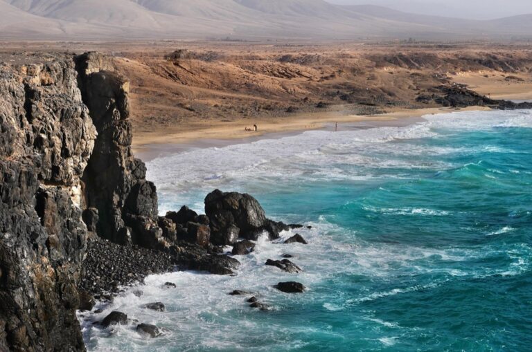
There’s a special kind of quiet you only find on a waterway that isn’t listed in the top ten search results. It’s the reward for paddling beyond the obvious boat ramp and the crowded beach. Finding these places isn’t about luck; it’s a skill built on curiosity and a little bit of detective work.
The goal is to find legal, safe, and sustainable access to less-traveled waters. This isn’t about trespassing or taking unnecessary risks. It’s about learning to read the landscape, both digitally and on the ground, to unlock paddling experiences that most people drive right past without a second glance. The effort you invest in research beforehand pays off tenfold in solitude on the water.
Scout New Routes with Google Earth and Gaia GPS
Digital mapping tools have completely changed the game for route discovery. Before you even touch a paddle, you can get a bird’s-eye view of an entire watershed. Use Google Earth’s satellite imagery to trace a river upstream, looking for potential access points like bridge crossings or unmarked dirt paths leading to the water. You can spot potential hazards, too—low-head dams, significant rapids, or logjams are often visible from above.
Once you identify a potential area, switch to a tool like Gaia GPS. Its power lies in its detailed map layers. You can overlay satellite imagery with topographic lines to understand the terrain and, crucially, with public and private land ownership parcels. This helps you answer the most important question: Can I legally access the water from here? Seeing a clear parcel of state forest or BLM land touching a river is a green light for exploration.
Don’t just look for official boat ramps. Scan for pull-offs on public roads that run alongside a creek or pond. Use the "measure distance" tool to see if it’s a reasonable walk to the water’s edge. Remember that satellite images can be outdated. A clear path on the map might be overgrown today, so treat your digital scouting as your primary lead, not a guarantee.
Tap Local Knowledge at Bait and Tackle Shops
The best maps can’t tell you about the submerged log that appeared after last spring’s flood or the new "No Parking" signs at a traditional access point. For that, you need human intelligence. Bait and tackle shops, small-town general stores, and local paddling outfitters are invaluable sources of on-the-ground information.
The key is to be a customer first and a question-asker second. Buy some gear, a snack, or even just a bottle of water. Strike up a genuine conversation. Instead of asking "Where are the secret spots?", try something more specific: "I was looking at putting in on Beaver Creek off the old logging road. Is the water high enough to paddle this time of year?" This shows you’ve done your homework and are looking for advice, not a handout.
These folks have a deep, practical understanding of the local waterways. They know which creeks are running, where the access is tricky, and what hazards to watch for. They are often the gatekeepers of local knowledge, and earning their trust by being respectful and prepared can unlock doors that no map ever could.
Unfold Secrets with a DeLorme Atlas & Gazetteer
In an era of GPS, a detailed paper map feels like an antique, but it’s one of the most powerful tools in your arsenal. The DeLorme Atlas & Gazetteer series is legendary among outdoorspeople for a reason. These large-format books provide a level of detail for backroads, public lands, and water access points that digital maps often miss entirely.
Spread a Gazetteer open on your table and you’ll see the relationship between roads, topography, and waterways in a way a small screen can’t replicate. You can spot tiny state forest tracts, unnamed ponds, and primitive boat launches on obscure dirt roads. Because it doesn’t rely on a battery or cell signal, it’s the ultimate backup and your primary tool for planning in remote areas.
Use the Gazetteer in conjunction with your digital tools. Find a promising blue line in the atlas, then cross-reference it on Google Earth to check for current conditions and obstacles. This combination of old-school detail and modern imagery is your most reliable method for confirming a route.
Follow Smaller Tributaries from Known Waterways
Sometimes the best secret spots are hiding in plain sight. Instead of searching for an entirely new lake or river, start on a waterway you already know and begin exploring its smaller, less-obvious tributaries. Every major river is fed by countless smaller creeks and streams, and many of them are navigable by kayak for at least a short distance.
Paddle to the mouth of a small creek that flows into your favorite lake. More often than not, other boaters will paddle right past it. Turn your bow and head upstream. You might only get a few hundred yards before it becomes too shallow or blocked, but you might also discover a serene, winding waterway that leads to a hidden pond or a secluded wildlife habitat.
This method requires a bit more improvisation and a willingness to turn back. Be mindful of water levels, as these smaller streams can change dramatically. What is a pleasant paddle in the spring might be an impassable rock garden by late summer. Always be prepared to encounter obstacles like fallen trees and beavers dams.
Find Public Access Using County GIS Map Portals
This is a next-level technique for the dedicated explorer. Nearly every county in the country maintains a public GIS (Geographic Information System) web portal, primarily for property tax assessment. For a paddler, these portals are a treasure map of public land and legal access points.
A county GIS map allows you to click on any parcel of land and see who owns it. You can turn on layers that show city, county, or state-owned properties. Look for public parcels that touch a river, lake, or stream. You might discover a forgotten county park, a public right-of-way, or a strip of state land that provides a perfect, legal spot to launch your kayak where no official ramp exists.
Learning to navigate these websites can take a little practice, as each county’s portal is different. Look for a "layers" or "parcels" menu to turn on ownership information. This method is the single best way to definitively confirm if an access point is on public or private land, removing all the guesswork and ensuring you are recreating responsibly and legally.
Leverage Seasonal Water Levels for New Routes
A waterway is not a static feature; it’s a living system that changes throughout the year. Understanding this seasonal rhythm can open up entirely new paddling destinations that are inaccessible for most of the year. High water levels in the spring, fed by snowmelt or rain, can transform a landscape.
During spring floods, you can often paddle through flooded timber forests or across marshy areas, exploring places that are dry land in the summer. These high-water routes offer a unique perspective and access to otherwise unreachable areas. Conversely, the low water levels of late summer or during a drought can expose beautiful sandbars and beaches perfect for a remote lunch spot, though they may also make some shallow rivers unnavigable.
Before heading out, always check a reliable source for current water levels and flow rates, like the USGS National Water Information System. Paddling a river at 500 cubic feet per second (CFS) is a vastly different—and potentially more dangerous—experience than paddling it at 100 CFS. Knowing the seasonal patterns of your local watersheds is key to both finding new routes and staying safe.
Final Safety and Leave No Trace Considerations
Exploring secluded waterways carries a higher degree of personal responsibility. When you leave the designated boat ramps and marked channels behind, your margin for error shrinks. Your safety becomes entirely your own responsibility, so preparation is non-negotiable.
Always file a float plan. Tell a reliable person exactly where you plan to put in, where you’re going, and when you expect to be back. Pack essential safety gear, including a PFD, a first-aid kit, extra water, and a reliable communication device. Scouting a new route means you don’t know what’s around the next bend, so paddle cautiously and be prepared for unexpected obstacles like downed trees or sudden changes in current.
• OSHA-Compliant Emergency Kit: Includes supplies including bandages, gauze, butterfly closures, burn cream packets, antibiotic ointment, BZK antiseptic towelettes, disposable gloves, scissors, and tweezers • Convenient Packaging: An ideal office first aid kit, home first aid kit, or car first aid kit, this set of safety-oriented office essentials comes in a durable plastic case complete with easy slide latches • Easy Access: This convenient and versatile work, home and car emergency kit features a clear cover and individual compartments that keep supplies neatly organized and easy to locate • Versatile: Ideal for homes, offices, construction vehicles, and more, this home and workplace first aid box helps you stay prepared for potential emergencies • HSA Eligible and FSA Eligible First Aid Kit: Stay prepared and prioritize your safety with this convenient FSA and HSA eligible first aid kit

Finally, these hidden places are special because they are unspoiled. Practice rigorous Leave No Trace principles. Pack out everything you pack in, including food scraps. Be respectful of wildlife and avoid disturbing their habitat. The goal is to leave the place looking as if you were never there, ensuring it remains a pristine and secret spot for the next person who puts in the work to find it.
The world is full of incredible places to paddle, and many of them aren’t on any map. By combining modern technology with a bit of old-fashioned exploration, you can move beyond the crowded launches and find the quiet water you’ve been searching for. The best adventures begin where the guidebook ends.