7 Best Weather Apps for Safe Lake Outings That Save Lives
Stay safe on lake outings with these 7 top weather apps. Get real-time alerts, marine forecasts, and hyper-local data to plan your perfect water adventure.
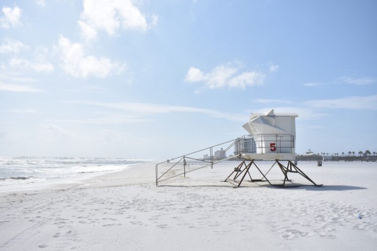
You’re planning the perfect lake day when dark clouds suddenly roll in — but it didn’t have to be a surprise. Weather conditions on lakes can change rapidly and create dangerous situations for boaters swimmers and anglers who aren’t prepared. The right weather app gives you the precise forecasts and real-time alerts you need to make smart decisions about when to head out and when to head home.
Disclosure: As an Amazon Associate, this site earns from qualifying purchases. Thank you!
Weather Underground: Hyper-Local Forecasting for Lake Conditions
Weather Underground stands out for its extensive network of personal weather stations that provide precise conditions right at your lake destination. You’ll get data from actual locations near the water rather than general regional forecasts.
Real-Time Weather Station Data
Track your home weather with the Ambient Weather WS-2902. This WiFi-enabled station measures wind, rain, temperature, and more, sending data to your smart home via IFTTT, Alexa, and Google Home.

Weather Underground pulls data from thousands of personal weather stations positioned around lakes nationwide. You’ll see current temperature, humidity, and barometric pressure readings from stations within miles of your specific launch point. This hyperlocal approach reveals microclimates that larger weather services miss entirely.
Hourly Wind Speed and Direction Updates
The app delivers wind forecasts broken down by hour with precise direction indicators crucial for safe boating. You can track wind shifts throughout your planned outing and spot dangerous crosswind patterns before they develop. These detailed updates help you time departures and returns when conditions favor your specific lake activities.
Radar Mapping for Storm Tracking
Weather Underground’s interactive radar lets you zoom directly onto your lake and track storm movement with 15-minute updates. You’ll spot developing cells hours before they arrive and watch their intensity change in real-time. The precipitation overlay shows exactly where rain will hit your location within the next few hours.
NOAA Weather Radar: Official Marine Weather Alerts
Stay informed with the Midland WR120B NOAA Weather Radio. It provides alerts for over 60 emergencies with S.A.M.E. localized programming and features a selectable alert tone for customized notifications.

NOAA Weather Radar delivers the gold standard for marine weather information directly from the National Weather Service. You’re getting official government data that mariners and commercial operators rely on for safety decisions.
National Weather Service Integration
NOAA Weather Radar pulls data straight from National Weather Service monitoring stations across your region. You’ll receive the same official forecasts and warnings that Coast Guard stations use for marine operations. This direct integration means zero delays between when hazardous conditions develop and when alerts reach your device.
Marine Weather Warnings and Advisories
The app delivers specialized marine alerts including small craft advisories and gale warnings specific to inland waters. You’ll get wind speed thresholds, wave height predictions, and visibility conditions tailored for lake recreation. These aren’t generic weather warnings – they’re crafted specifically for boaters and water sports enthusiasts.
Buoy Data for Lake Conditions
NOAA’s extensive buoy network provides real-time water temperature, wave height, and wind measurements from actual lake locations. You can access current conditions from buoys positioned throughout major lake systems like the Great Lakes. This on-water data gives you precise conditions that shoreline weather stations simply can’t capture.
Windy: Advanced Wind and Wave Visualization
Windy transforms complex meteorological data into stunning visual displays that make wind patterns instantly understandable. This European-based app excels at showing you exactly what’s happening on your lake through interactive maps and precise forecasting tools.
Interactive Wind Pattern Maps
Windy’s animated wind flow maps reveal exactly how air moves across your water body in real-time. You’ll see wind convergence zones where gusts intensify and calm pockets where conditions stay stable.
The color-coded overlay system shows wind speeds at a glance – deep blues indicate light breezes while reds signal strong winds. You can adjust the map’s altitude levels to see how upper-atmosphere winds might affect surface conditions later.
Wave Height and Direction Forecasts
Wave predictions on Windy extend up to 10 days out with hourly breakdowns for the next 48 hours. The app calculates wave height, period, and direction using advanced oceanographic models.
Color-coded wave overlays make it easy to spot building swells before they reach dangerous levels. You’ll see exactly which shorelines will face the largest waves and which areas offer protected waters during storms.
Lightning Detection Features
Real-time lightning strikes appear as bright flashes on Windy’s radar with timestamps showing strike age. The app tracks electrical activity within a 500-mile radius and predicts storm movement patterns.
Lightning density maps help you identify the most active storm cells approaching your location. You can set custom alerts for strikes within specific distances of your position to ensure adequate warning time.
Weather Channel App: Comprehensive Lake Weather Planning
The Weather Channel app delivers the most comprehensive weather intelligence for lake planning, combining advanced meteorological data with user-friendly interfaces. You’ll get everything needed to make informed decisions about your water activities.
15-Day Extended Forecasts
Extended forecasting lets you plan lake trips weeks ahead, identifying optimal weather windows for camping or multi-day fishing expeditions. The app’s 15-day outlook shows temperature trends, precipitation patterns, and wind conditions that help you reserve campsites during favorable periods. You’ll spot upcoming storm systems early enough to reschedule activities or prepare for changing conditions.
Severe Weather Notifications
Customizable alerts deliver critical warnings directly to your phone, including tornado watches, severe thunderstorm warnings, and flash flood advisories. You can set location-based notifications for specific lakes or boat launches, ensuring you receive timely alerts even when traveling. The app’s push notifications include detailed severity levels and recommended actions for each weather threat.
Hourly Precipitation Probability
Hour-by-hour rain forecasts show exactly when precipitation will start and stop, helping you time launches and returns perfectly. The app displays precipitation intensity levels, distinguishing between light drizzle and heavy downpours that could create dangerous boating conditions. You’ll see probability percentages for each hour, allowing you to identify brief weather windows between storm cells.
AccuWeather: Minute-by-Minute Precipitation Tracking
AccuWeather’s precision-focused approach transforms lake outing preparation by delivering hyperlocal weather intelligence that helps you stay ahead of rapidly changing conditions.
MinuteCast Precipitation Forecasts
MinuteCast delivers precipitation forecasts down to your exact lake location for the next two hours. You’ll know whether that approaching cloud will drop rain in 23 minutes or bypass your area entirely.
This minute-by-minute precision helps you time activities like launching your boat or setting up lakeside gear. The feature proves invaluable when you’re deciding whether to pack up camp or wait out a brief shower.
RealFeel Temperature for Comfort Planning
RealFeel temperature accounts for humidity, wind chill, and sun intensity to show how the weather actually feels on your skin. Standard temperature readings often mislead you about true comfort levels near water.
You’ll make better decisions about clothing layers and sun protection when you know it feels like 95°F despite an 85°F air temperature. This metric becomes crucial for planning extended water activities and preventing heat-related discomfort.
Get powerful sun protection with Neutrogena Ultra Sheer SPF 70. This lightweight, non-greasy formula absorbs quickly, leaving a clean, matte finish while shielding skin from UVA/UVB rays.

UV Index Monitoring for Sun Safety
UV index tracking alerts you to dangerous radiation levels that intensify near reflective lake surfaces. Water reflection can increase UV exposure by up to 15%, making standard sun safety guidelines inadequate.
AccuWeather’s hourly UV forecasts help you schedule activities during safer periods and adjust your sunscreen application accordingly. You’ll avoid the painful surprise of severe sunburn that ruins the rest of your lake vacation.
Dark Sky: Hyperlocal Weather Down to the Minute
Dark Sky revolutionized lake weather tracking by delivering precision forecasts down to your exact location. This app’s shutdown in 2023 left many lake enthusiasts searching for similar hyperlocal accuracy.
Precise Precipitation Timing
Dark Sky’s signature feature provided minute-by-minute precipitation forecasts for specific lake coordinates. You’d know exactly when that afternoon thunderstorm would hit your fishing spot, giving you time to pack gear and seek shelter. The app’s hyperlocal data often revealed rain patterns that bypassed your lake entirely while hitting areas just miles away.
Temperature Trend Analysis
The app tracked temperature fluctuations throughout your lake day with remarkable precision. You could plan morning fishing trips knowing exactly when water temperatures would rise enough to send fish deeper. Dark Sky’s hourly breakdowns helped you time activities like swimming or paddleboarding when conditions felt most comfortable for extended water exposure.
Enjoy versatile water activities with the Roc Paddle Board. Its stable, wide design and durable construction provide excellent balance, while included accessories like a paddle and carry bag ensure a complete, portable experience.

Customizable Weather Alerts
Dark Sky let you set personalized alerts for specific weather thresholds at your favorite lake locations. You’d receive notifications when wind speeds exceeded safe boating limits or when lightning approached within your chosen radius. These targeted alerts prevented countless dangerous situations by giving lake-goers advance warning tailored to their specific safety needs and activity plans.
PredictWind: Professional Marine Weather Forecasting
PredictWind transforms your lake outings with marine-focused forecasting that rivals professional sailing services. This app brings commercial-grade weather intelligence to recreational boaters who demand precision for safe lake navigation.
Multiple Weather Model Comparisons
PredictWind compares forecasts from leading weather models including GFS, ECMWF, and GEFS in real-time. You’ll see wind speed variations between models displayed side-by-side, helping you identify consensus patterns or conflicting predictions. This comparison reveals which models perform best for your specific lake’s microclimate conditions.
Detailed Marine Forecasts
The app delivers marine-specific data including wave height predictions, water temperature trends, and detailed wind analysis at multiple altitudes. You’ll receive visibility forecasts crucial for morning launches and sea state conditions that affect boat handling. Marine weather warnings integrate seamlessly with tide predictions for comprehensive water safety planning.
Offline Weather Map Downloads
PredictWind’s offline capability ensures weather access even in remote lake locations with poor cellular coverage. You can download detailed weather maps covering up to 14 days of forecasts before heading out. The offline maps include wind patterns, precipitation radar, and temperature overlays that remain accessible without internet connectivity.
Conclusion
Your safety on the water depends on having reliable weather information at your fingertips. These seven apps provide the specialized forecasting tools you need to make smart decisions about your lake activities.
From Weather Underground’s hyper-local data to PredictWind’s professional marine forecasts each app offers unique advantages for different types of water recreation. Whether you’re planning a weekend fishing trip or managing a commercial boating operation you’ll find the right combination of features to keep you informed.
Download a few of these apps before your next lake outing and test their accuracy for your specific location. The time you spend familiarizing yourself with their features could make the difference between a perfect day on the water and a dangerous weather emergency.
Frequently Asked Questions
What weather apps are most reliable for lake activities?
Weather Underground, NOAA Weather Radar, Windy, Weather Channel, AccuWeather, and PredictWind are top choices for lake weather tracking. Each offers unique features like hyper-local forecasting, marine-specific alerts, real-time lightning detection, and minute-by-minute precipitation forecasts to help ensure safe water activities.
Why is Weather Underground particularly useful for lake weather?
Weather Underground provides hyper-local forecasting through an extensive network of personal weather stations near water bodies. It offers precise current conditions, reveals microclimates that larger services miss, and provides hourly wind updates crucial for boating safety, plus interactive radar for real-time storm tracking.
What makes NOAA Weather Radar essential for boaters?
NOAA Weather Radar delivers official marine weather information from the National Weather Service, providing reliable data for safety decisions. It integrates monitoring station data and offers specialized marine alerts tailored for lake recreation, ensuring mariners receive timely hazardous condition warnings.
How does Windy help visualize weather conditions?
Windy transforms complex meteorological data into visually engaging displays, making wind patterns easily understandable through interactive wind flow maps. It features real-time lightning detection with custom alerts for nearby electrical activity, helping users track dangerous weather conditions approaching their lake location.
What unique features does AccuWeather offer for lake planning?
AccuWeather’s MinuteCast provides minute-by-minute precipitation forecasts for specific lake locations. Its RealFeel temperature accounts for humidity and wind chill, while UV index monitoring alerts users to dangerous radiation levels intensified by reflective lake surfaces, enhancing safety planning.
Is Dark Sky still available for weather tracking?
No, Dark Sky was shut down in 2023. However, it was previously known for revolutionary precision forecasts, minute-by-minute precipitation timing, detailed temperature trend analysis, and customizable weather alerts for specific thresholds that helped lake-goers plan their activities safely.
What makes PredictWind suitable for serious boaters?
PredictWind provides commercial-grade weather intelligence by comparing forecasts from multiple leading weather models in real-time. It offers marine-specific data including wave height predictions, visibility forecasts, and offline weather map downloads for remote lake locations.
Why do lake conditions change so quickly?
Lake environments create unique microclimates due to water temperature differences, surrounding terrain, and wind patterns. These factors can cause rapid weather shifts that pose risks to boaters, swimmers, and anglers, making real-time weather monitoring essential for safety.
How can weather apps prevent lake accidents?
Weather apps provide real-time alerts for dangerous conditions like sudden storms, high winds, and lightning. Features like radar tracking, marine weather warnings, and precipitation forecasts help users make informed decisions about when to leave the water or seek shelter.
What weather information is most critical for lake safety?
Wind speed and direction, lightning activity, precipitation timing, and storm movement are crucial for lake safety. Temperature trends, UV levels, wave heights, and visibility conditions also significantly impact safety decisions for various water activities.