7 Ways How to Get Personalized Weather Forecasts for Water Enthusiasts
Discover specialized marine weather apps and services that provide hyper-local forecasts, wind data, wave heights, and safety alerts for sailors, surfers, and water sports enthusiasts.
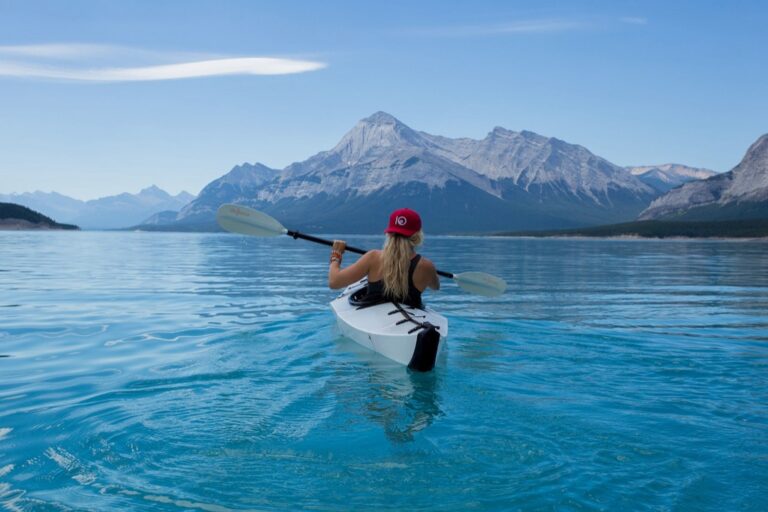
Whether you’re planning a sailing adventure or checking surf conditions, generic weather apps often miss the mark for water activities. The details matter — wind speed, wave height, and tide patterns can make or break your day on the water.
The smart move? Switching to specialized weather services that cater specifically to boaters, surfers, and other water enthusiasts. These platforms deliver hyper-local forecasts with marine-specific data you won’t find in standard weather apps.
Bottom line: Getting personalized water weather forecasts isn’t just about convenience — it’s about safety and maximizing your time on the water.
Disclosure: As an Amazon Associate, this site earns from qualifying purchases. Thank you!
Understanding Why Water Enthusiasts Need Specialized Weather Data
Standard weather apps don’t capture the complex conditions that make or break your day on the water. You need precise marine data that accounts for local geography and water-specific phenomena.
Wind Speed and Direction for Sailing and Surfing
Wind conditions change dramatically across water surfaces compared to land measurements. You’ll find that onshore winds create different wave patterns than offshore winds, while cross-shore winds affect your ability to control boards and sails. Sustained wind speeds matter more than gusts for planning longer sessions.
Wave Height and Swell Predictions for Ocean Activities
Wave forecasts require understanding both local wind waves and distant swells traveling across oceans. You need to know wave period and direction to predict surf quality and safety conditions. Short-period choppy waves create different challenges than long-period swells for activities like kayaking and stand-up paddleboarding.
Enjoy versatile water activities with the Roc Paddle Board. Its stable, wide design and durable construction provide excellent balance, while included accessories like a paddle and carry bag ensure a complete, portable experience.

Water Temperature Forecasts for Swimming and Diving
Water temperature affects your comfort level and safety equipment requirements for extended water exposure. You’ll need different wetsuit thickness based on seasonal temperature variations and thermoclines at diving depths. Surface temperatures can vary significantly from deeper water temperatures where you’ll be swimming or diving.
Choosing the Right Weather Apps for Marine Activities
Marine weather apps make the difference between a great day on the water and a dangerous situation. The right app puts critical marine data right in your pocket.
Marine-Specific Forecasting Applications
Windy delivers detailed wind and wave overlays with hourly updates perfect for sailors and surfers. PredictWind offers professional-grade routing and weather modeling used by racing crews worldwide. SailFlow specializes in real-time wind observations from coastal stations, while Buoyweather provides comprehensive marine forecasts including swell direction and period data that standard apps simply don’t offer.
Features to Look for in Water Sports Weather Apps
Real-time buoy data gives you actual conditions rather than predictions from shore-based stations. Look for apps that display wind barbs showing both speed and direction at a glance. Swell period and direction indicators help you understand wave quality, while tidal charts integrated with weather data prevent you from getting caught in dangerous conditions during tide changes.
Free vs Premium Weather Service Options
Free versions typically provide basic wind and wave forecasts suitable for casual weekend activities. Premium subscriptions unlock extended forecasts, detailed marine charts, and professional-grade features like storm tracking and routing optimization. Most serious water enthusiasts find the $10-30 monthly cost worthwhile for the safety margin and planning advantages that premium marine weather data provides.
Setting Up Location-Based Weather Alerts
Location-based alerts transform your weather monitoring from passive checking to active notifications. They’ll ping you when conditions change at your favorite spots, giving you the jump on perfect sailing winds or warning you about incoming storms.
GPS Integration for Real-Time Location Updates
Enable GPS tracking in your marine weather app to receive automatic alerts for your current location. This feature updates your weather data as you move between different water bodies or travel to new sailing destinations. Apps like Windy and PredictWind use GPS to deliver hyper-local forecasts within a 1-mile radius of your position.
Track vehicles and assets with the LandAirSea 54 GPS Tracker. Get real-time location alerts and historical playback using web-based software or the SilverCloud App.

Creating Custom Geographic Zones for Multiple Water Bodies
Set up multiple custom zones for all your regular water spots – your home marina, favorite surf break, and weekend lake house. Most premium apps allow 5-10 saved locations with unique alert settings for each zone. You can customize wind speed thresholds, wave height warnings, and storm alerts differently for each location based on your specific activities there.
Configuring Push Notifications for Weather Changes
Configure notifications to trigger based on your activity requirements – 15+ knot winds for sailing, 3+ foot waves for surfing, or storm warnings for any water activity. Set timing preferences to receive alerts 2-6 hours before conditions change, giving you enough time to prepare gear or modify plans. Turn off non-essential notifications to avoid alert fatigue while keeping critical safety warnings active.
Customizing Weather Parameters for Your Water Activities
Fine-tuning your weather parameters transforms generic forecasts into precision tools for water activities. Each sport demands specific thresholds that determine whether conditions are safe, challenging, or perfect for your skill level.
Tailoring Wind Forecasts for Sailing and Kitesurfing
Wind speed thresholds separate safe sessions from dangerous conditions for sailors and kitesurfers. Set alerts for your minimum wind requirements—typically 8-12 knots for beginners, 15-25 knots for intermediate sailors.
Configure wind direction parameters to match your launch sites and sailing areas. Offshore winds create flat water but pose safety risks, while onshore winds generate waves but offer easier rescue scenarios.
Setting Wave and Tide Preferences for Surfing
Wave height preferences vary dramatically between longboarders seeking 2-4 foot swells and experienced shortboarders hunting 6-8 foot breaks. Customize swell period alerts since longer periods (12+ seconds) create cleaner, more powerful waves.
Tide timing becomes crucial for reef breaks and beach breaks that only work during specific tidal windows. Set notifications for optimal tide ranges at your home breaks to maximize session quality.
Adjusting Temperature Alerts for Swimming Conditions
Water temperature thresholds determine wetsuit requirements and safe exposure times for swimmers and divers. Configure alerts for temperature drops below 70°F when you’ll need thermal protection for extended sessions.
Air temperature differentials become critical when exiting cold water—set parameters that account for wind chill effects. A 15-degree difference between water and air temperature can cause rapid heat loss during surface intervals.
Utilizing Professional Marine Weather Services
Professional marine weather services deliver the precision and reliability that serious water enthusiasts demand for safe navigation and optimal conditions.
NOAA Marine Weather Services and Resources
Stay connected and safe on the water with the Cobra MR HH350 FLT. This 6-watt handheld VHF radio features a noise-canceling mic for clear communication and floats for easy retrieval.

NOAA’s National Weather Service provides the gold standard for marine forecasting through their dedicated marine weather broadcasts and online portals. You’ll find comprehensive offshore forecasts, coastal marine warnings, and real-time observations from their extensive buoy network at weather.gov/marine.
Their VHF weather radio broadcasts on channels WX1-WX7 deliver continuous updates every few minutes, making them invaluable when you’re already on the water without reliable internet access.
Commercial Marine Forecasting Platforms
Commercial services like PredictWind Pro and WeatherRouting.com offer sophisticated modeling that goes beyond basic NOAA data. These platforms combine multiple weather models to provide ensemble forecasting, giving you probability-based predictions rather than single-point forecasts.
Many professional charter operators and racing sailors rely on these services because they provide routing optimization and detailed analysis that can save hours of travel time.
Accessing Buoy Data and Weather Station Information
Real-time buoy data from NOAA’s National Data Buoy Center gives you actual conditions rather than predictions. You can access wave height, wind speed, and water temperature measurements updated every hour through their interactive maps at ndbc.noaa.gov.
This data becomes crucial when forecasts show borderline conditions – the difference between a 15-knot prediction and 18-knot reality can determine whether your sailing trip becomes exhilarating or exhausting.
Integrating Multiple Weather Data Sources
You’ll get the most accurate water forecasts by combining different weather data sources rather than relying on a single app or service. This multi-source approach helps you spot inconsistencies and build confidence in your conditions assessment.
Combining Satellite Imagery with Local Forecasts
Satellite imagery shows you what’s actually happening while local forecasts predict what should happen next. Apps like Windy display real-time satellite data alongside model predictions, letting you see if cloud formations match the forecast. You can spot approaching weather systems hours before they hit your location and verify if predicted wind patterns align with actual cloud movement.
Cross-Referencing Multiple Weather Models
Different weather models excel in different conditions and timeframes. The European ECMWF model typically performs better for 3-7 day forecasts while the American GFS model often provides more accurate short-term predictions. Compare forecasts from PredictWind, Windy, and NOAA to identify consensus patterns. When models disagree significantly, expect more volatile conditions than any single forecast suggests.
Using Radar Data for Short-Term Planning
Radar data gives you the most reliable 0-6 hour outlook for precipitation and storm movement. NOAA’s radar shows actual weather movement rather than predictions, making it invaluable for launch timing. You can track storm cells moving toward your location and estimate arrival times within 30-60 minutes. Doppler radar also reveals wind shear patterns that could create sudden gusts or lulls.
Creating Weather-Based Activity Schedules
Smart scheduling transforms scattered weather data into actionable plans that maximize your time on the water. You’ll discover how strategic planning around forecasts creates more successful outings and safer adventures.
Planning Multi-Day Water Adventures
Extended trips require analyzing weather patterns across several days to identify optimal windows. Start by mapping 7-day forecasts to spot consistent conditions that align with your activities.
Look for 2-3 day stable weather blocks rather than perfect single days. Wind patterns often shift every 48-72 hours, creating natural planning segments for different water activities throughout your trip.
Setting Weather Thresholds for Safe Activity Conditions
Define specific trigger points for each activity before checking forecasts to avoid subjective decision-making on the water. Establish wind speed limits, wave height maximums, and visibility minimums for your skill level.
Beginner sailors shouldn’t exceed 15-knot winds, while experienced kayakers can handle 20+ knots in protected waters. Create go/no-go criteria that account for combined conditions rather than single variables.
Building Flexible Itineraries Based on Forecasts
Design backup plans for different weather scenarios rather than rigid day-by-day schedules. Assign primary and alternate activities to each day based on forecast confidence levels.
Keep high-wind activities like kitesurfing and low-wind options like paddleboarding in your toolkit. Weather apps show forecast uncertainty through confidence percentages, helping you decide when flexibility matters most.
Leveraging Social Weather Networks and Communities
Water enthusiasts have discovered that the most accurate forecasts often come from fellow paddlers, sailors, and surfers who’re actually out on the water. These social networks create real-time weather intelligence that supplements traditional forecasting services.
Connecting with Local Water Sports Communities
Local water sports groups on Facebook and WhatsApp provide invaluable weather insights from experienced enthusiasts who know your specific waters. You’ll find sailors sharing wind observations, surfers reporting wave conditions, and kayakers discussing current patterns throughout the day.
Join location-specific groups like “Lake Tahoe Sailors” or “Outer Banks Surfing” where members post morning condition reports and afternoon updates. These communities often include meteorology enthusiasts who provide detailed explanations of approaching weather systems.
Sharing Real-Time Weather Observations
Contributing your own weather observations helps build community knowledge while improving everyone’s forecasting accuracy. Report actual wind speeds, wave heights, and visibility conditions when you’re on the water using apps like Windy or direct group messaging.
Share photos and videos of current conditions with timestamps and GPS coordinates to help others make informed decisions. Your on-water reports become valuable data points that verify or contradict official forecasts for your specific location.
Accessing Crowd-Sourced Weather Reports
Platforms like SailFlow and Windy integrate user-generated weather reports with professional forecasting data to create comprehensive condition updates. You’ll access real-time wind readings from private weather stations and sailor reports across hundreds of locations.
These crowd-sourced reports often reveal microclimates and local weather patterns that official buoys miss. Check community weather boards on iWindsurf or Magicseaweed for spot-specific conditions updated every few hours by local enthusiasts.
Advanced Weather Monitoring Tools and Equipment
Beyond smartphone apps and online forecasts, dedicated weather monitoring equipment provides the precision data that serious water enthusiasts need for optimal safety and performance.
Personal Weather Stations for Waterfront Properties
Track your home weather with the Ambient Weather WS-2902. This WiFi-enabled station measures wind, rain, temperature, and more, sending data to your smart home via IFTTT, Alexa, and Google Home.

Personal weather stations transform waterfront properties into private forecasting centers. Davis Instruments Vantage Pro2 and Ambient Weather WS-2902 deliver real-time wind speed, direction, and barometric pressure directly from your dock or shoreline.
These stations capture hyperlocal conditions that apps can’t match. Your Davis station reveals wind shifts 15-30 minutes before they hit the water, giving you crucial planning time for launches or gear adjustments.
Portable Weather Instruments for On-the-Go Monitoring
Handheld weather meters provide instant readings when you’re away from fixed stations. Kestrel 3000 and WeatherHawk WM-200 measure wind speed, temperature, and humidity in seconds at boat ramps or beaches.
Professional fishing guides rely on Kestrel 5500 units for barometric pressure trends that predict fish behavior. These compact tools fit in tackle boxes and deliver lab-quality data when cellular coverage fails.
Smartphone Sensors and Weather Measurement Apps
Enjoy vivid content on the Galaxy A16 5G's large 6.7" display and capture stunning photos with its triple-lens camera. Plus, get peace of mind with its durable design and six years of guaranteed updates.

Modern smartphones contain sophisticated sensors that apps can leverage for weather monitoring. Barometer Plus uses your phone’s pressure sensor to track storm approaches, while Wind Meter apps utilize GPS and accelerometer data for basic wind measurements.
WeatherSignal crowdsources data from millions of phones to improve local forecasts. Your device contributes pressure, temperature, and humidity readings that enhance community weather accuracy for your favorite launch spots.
Conclusion
Getting personalized weather forecasts for your water activities transforms your time on the water from risky guesswork into confident adventures. By combining specialized marine apps with professional weather services and real-time data sources you’ll make better decisions about when to launch and when to stay ashore.
The key is layering multiple information sources rather than relying on a single weather app. Your smartphone equipped with marine-focused forecasting tools plus community insights from local water sports networks creates a powerful weather intelligence system that keeps you safer and more successful on the water.
Start implementing these strategies today and you’ll quickly notice the difference in your planning accuracy and overall enjoyment during your water-based adventures.
Frequently Asked Questions
Why are generic weather apps inadequate for water activities?
Generic weather apps lack essential marine-specific data like wind speed variations over water, wave height predictions, swell direction, and tide patterns. These apps provide basic land-based forecasts that don’t capture the complex conditions affecting sailing, surfing, and other water activities, potentially compromising safety and performance on the water.
What key features should I look for in marine weather apps?
Look for real-time buoy data, wind barbs showing speed and direction, integrated tidal charts, wave height and swell predictions, and hyper-local forecasting capabilities. Premium features often include advanced modeling, routing optimization, and customizable alerts tailored to specific water activities and locations.
Which marine weather apps are recommended for water enthusiasts?
Top recommended apps include Windy for comprehensive visualization, PredictWind for advanced sailing forecasts, SailFlow for wind-specific data, and Buoyweather for detailed marine conditions. Each offers unique features like real-time buoy integration, professional-grade modeling, and activity-specific customization options.
How do location-based weather alerts improve water safety?
Location-based alerts transform passive weather checking into active monitoring by sending push notifications when conditions change at your favorite spots. GPS integration enables hyper-local forecasts within a 1-mile radius, while custom geographic zones allow tailored alert parameters for different water bodies and activities.
What professional marine weather services should serious water enthusiasts use?
NOAA’s National Weather Service provides gold-standard marine forecasting with offshore forecasts, coastal warnings, and real-time buoy data. Commercial platforms like PredictWind Pro and WeatherRouting.com offer advanced modeling and routing optimization. VHF weather radio broadcasts provide crucial on-water updates.
Why should I integrate multiple weather data sources?
Combining satellite imagery, local forecasts, different weather models, and radar data provides more accurate predictions. Various models excel in different conditions and timeframes, while cross-referencing sources helps verify predictions and identify approaching weather systems for better decision-making.
How can I create effective weather-based activity schedules?
Analyze multi-day weather patterns to identify stable weather blocks rather than perfect single days. Set specific weather thresholds for safe conditions, build flexible itineraries with backup plans, and focus on forecast confidence levels rather than just ideal conditions.
What role do social weather networks play in marine forecasting?
Local water sports communities on platforms like Facebook and WhatsApp provide real-time insights from experienced enthusiasts. Crowd-sourced weather reports and user-generated data help reveal microclimates and local patterns, enhancing overall forecasting accuracy for specific locations.
What advanced weather monitoring equipment is recommended?
Personal weather stations like Davis Instruments Vantage Pro2 provide real-time waterfront conditions. Portable instruments like Kestrel 3000 offer instant on-the-go readings. Smartphone sensors and weather apps leverage mobile technology to improve local forecasts through community contributions.
How do I customize weather parameters for different water activities?
Set specific wind speed and direction thresholds for sailing and kitesurfing. Adjust wave height and tide preferences for surfing based on skill level. Configure temperature alerts for swimming activities. Fine-tuning these settings transforms generic forecasts into precision tools for each activity.