7 Best Lake Maps For Swimming To Find Crystal Waters
Discover the 7 best lake maps for finding pristine swimming spots. Our guide helps you locate crystal-clear waters and safe access points for your next dip.
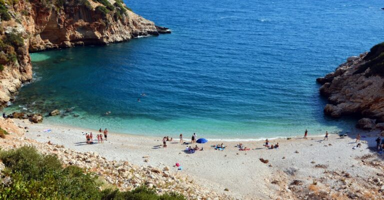
Nothing beats the feeling of diving into a pristine, crystal-clear lake on a sweltering summer afternoon. However, finding that perfect swimming spot requires more than just luck; it demands a strategic look at underwater topography and water quality data. By utilizing the right digital tools, you can transform your next lake trip from a muddy guessing game into a refreshing, high-visibility adventure.
Disclosure: As an Amazon Associate, this site earns from qualifying purchases. Thank you!
Navigating Lake Water Quality and Clarity Data
Before you pack your goggles, you must understand that water clarity isn’t just about aesthetics; it’s about safety and ecosystem health. Lakes are dynamic environments where runoff, algae blooms, and sediment shifts can change visibility overnight. Relying on outdated local knowledge often leads to disappointment, as weather patterns significantly alter the "swimmability" of your favorite coves.
True water clarity is best assessed by looking for Secchi disk data, which measures the depth at which a black-and-white disk disappears from sight. While not every lake has a public monitoring program, state environmental agencies often publish annual reports on trophic status. Always prioritize lakes with "oligotrophic" labels, as these are nutrient-poor, deep, and significantly clearer than their murky, algae-prone counterparts.
Navionics Boating App for Depth and Clarity
Navionics is the gold standard for anyone who wants to see exactly what lies beneath the surface before they drop anchor. While primarily designed for boaters, its high-definition bathymetric charts are incredibly useful for swimmers looking for a gradual, sandy-bottomed entry. You can easily identify deep drop-offs and shallow shelves, which helps you avoid stepping into unexpected muck or dangerous underwater debris.
I recommend Navionics if you are the type of swimmer who values precision and wants to map out a safe, clear-water perimeter before arriving. It is perfect for those who frequent larger, well-charted lakes where underwater terrain varies wildly. If you are looking for a shallow, sandy beach, this is your primary tool for verification.
Garmin ActiveCaptain for Hidden Swimming Coves
Garmin ActiveCaptain takes the guesswork out of finding secluded spots by leveraging a massive community-driven database. It’s not just about maps; it’s about the "ActiveCaptain Community" pins that offer real-time feedback on anchorage quality and beach accessibility. If a cove is prone to weeds or has a rocky, difficult entry, you will likely find a warning here from a fellow water enthusiast.
This app is the best choice for explorers who want to venture beyond the crowded public beaches. It’s ideal for those who have a boat or kayak and need to know which coves offer the best swimming conditions. If you value community intelligence over raw topographical data, ActiveCaptain is an essential addition to your digital toolkit.
Lake Link Maps for Localized Water Conditions
Lake Link stands out because it blends topographical mapping with hyper-localized fishing and water reports. Because anglers are constantly monitoring water temperature and clarity to track fish, their reports serve as a fantastic proxy for swimming conditions. You can quickly scan recent logs to see if a lake is experiencing a "murky" period due to recent heavy rains.
Use Lake Link if you want to know what the water actually looks like right now, rather than just what the map says it should look like. It is particularly effective for smaller, inland lakes that don’t get the attention of larger boating charts. If you want to avoid a wasted trip, checking these recent user reports is a non-negotiable step.
Fishidy App for Finding Clear Sandy Bottoms
Fishidy is a powerhouse for identifying bottom composition, which is the secret to finding those coveted "crystal water" zones. By analyzing the map layers, you can distinguish between soft, silty bottoms that cloud up when you swim and hard, sandy flats that keep the water pristine. It essentially allows you to "see" the bottom texture before you ever touch the water.
This app is tailor-made for the swimmer who hates the sensation of sinking into lake-bottom muck. It is an excellent resource for those who prioritize a clean, firm surface for wading and swimming. If you are tired of guessing what you are standing on, Fishidy provides the clarity you need to choose your spot with confidence.
C-MAP Genesis for Detailed Shoreline Mapping
C-MAP Genesis is all about high-resolution, user-generated contour maps that reveal the intricate details of the shoreline. Unlike standard maps that might blur out smaller inlets, C-MAP allows for incredibly detailed views of the transition zones between land and water. This is vital for finding those small, hidden pockets where the water is often calmest and clearest.
This tool is for the power user who wants to create their own custom maps and see the lake in high definition. It is perfect for those who spend their summers on the same lake and want to map out every secret swimming hole. If you are a detail-oriented person who wants to master your local lake’s geography, C-MAP is the way to go.
USGS WaterWatch for Real-Time Clarity Levels
USGS WaterWatch is the professional-grade tool for monitoring the actual physical state of the water. By tracking flow rates and turbidity levels at various gauging stations, it provides scientific data on whether a lake is experiencing a surge in sediment. This is the most reliable way to determine if a lake is "safe" after a major weather event.
I suggest using this as a safety check rather than a navigation tool. It is essential for anyone swimming in lakes connected to river systems, where water quality can shift rapidly. If you are concerned about water safety and recent runoff, this is the most objective source of information you will find.
Google Earth Pro for Aerial Visibility Checks
Sometimes, the best map is a bird’s-eye view. Google Earth Pro allows you to look at historical satellite imagery, which can reveal the tell-tale turquoise or deep blue hues of clear water. By toggling through the "Historical Imagery" feature, you can see how the water clarity changes across different seasons and years.
This is the perfect tool for visual learners who want to scout a location before committing to a trip. It is highly effective for identifying large, clear-water bays that might be invisible on a standard contour map. If you want to see the "big picture" of a lake’s water quality, nothing beats the satellite perspective.
CalTopo Tools for Topographic Beach Access
CalTopo is an incredible resource for understanding the elevation and accessibility of the shoreline. While many apps focus on what is under the water, CalTopo excels at showing you how to get to the water’s edge. It helps you identify steep, dangerous cliffs versus gradual, accessible beach entries that are perfect for swimming.
This is the go-to tool for adventurers who hike to their swimming spots. It is ideal for those who prioritize safety and ease of access when scouting remote lake locations. If your goal is to find a secluded beach that is actually reachable, CalTopo provides the topographical context you need.
Evaluating Lake Maps for Safe Swimming Spots
When choosing your swimming destination, always cross-reference your topographical map with current environmental data. A beautiful, sandy-bottomed cove on a map is useless if the water quality is poor or if the area is prone to stagnant conditions. Always prioritize lakes with high turnover rates and avoid swimming near storm drains or heavy agricultural runoff.
- Check the map: Look for sandy, shallow shelves on Navionics or Fishidy.
- Check the data: Use USGS or local reports to ensure the water is clean.
- Check the access: Use CalTopo to ensure your route to the water is safe.
Remember that nature is unpredictable, and even the clearest lakes can change with the wind. Approach your swimming spot with a "safety-first" mindset, and always be prepared to pivot to a different location if the conditions aren’t right. By combining these digital tools with a bit of common sense, you will spend far more time enjoying the water and far less time searching for it.
Finding crystal-clear water is a blend of digital scouting and real-world awareness that pays off the moment you submerge. By utilizing these mapping tools, you move from being a passive visitor to an informed explorer of the lake’s hidden gems. Keep your gear ready, your maps updated, and enjoy the refreshing rewards of a well-planned swim.