7 Techniques for Safe Lake Navigation That Prevent Emergencies
Master safe lake navigation with 7 essential techniques. Learn GPS basics, weather planning, emergency protocols & defensive boating to avoid hidden dangers.
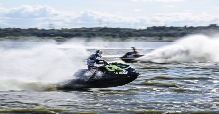
Navigating lakes might seem simpler than ocean sailing, but hidden hazards and sudden weather changes can quickly turn your peaceful day on the water into a dangerous situation. You’ll face unique challenges including shallow areas, submerged obstacles, and rapidly shifting wind patterns that can catch even experienced boaters off guard.
Smart navigation techniques make the difference between a memorable adventure and a costly rescue operation. The right preparation and knowledge keep you safe while maximizing your time on the water.
Disclosure: As an Amazon Associate, this site earns from qualifying purchases. Thank you!
Understanding Lake Characteristics and Hazards
Lake navigation requires understanding each body of water’s unique personality. What appears calm on the surface often conceals challenges that can turn your peaceful outing into a dangerous situation.
Water Depth Variations and Underwater Obstacles
Depth changes happen fast on lakes. You’ll encounter drop-offs that plunge from 3 feet to 30 feet within a boat length. Submerged rocks, fallen trees, and old dock pilings lurk just below the surface where you can’t see them. These hazards cluster near shorelines, around islands, and in areas where seasonal water levels have exposed then re-covered obstacles.
Weather Pattern Recognition
Lake weather shifts without warning. Morning glass can become afternoon chaos as thermal winds pick up around 2 PM. Watch for towering cumulus clouds building on the horizon – they signal incoming thunderstorms with dangerous lightning and sudden wind gusts. Temperature differences between water and surrounding land create localized weather patterns that don’t match regional forecasts.
Current and Wind Direction Assessment
Wind patterns on lakes follow predictable daily cycles. Thermal currents flow from cool water toward warm shorelines during afternoon heating. Evening brings reverse flow as land cools faster than water. Narrow channels between islands or peninsulas funnel and accelerate winds beyond open-water speeds. Always check which direction offers protected water before you launch.
Mastering Essential Navigation Equipment
Your navigation equipment serves as your digital compass and lifeline on the water. Quality gear makes the difference between confidently exploring new areas and finding yourself lost in unfamiliar waters.
GPS and Chart Plotter Usage
Navigate confidently with the Simrad Cruise 5-inch GPS chartplotter. Preloaded with US Coastal C-MAP charts and an 83/200 transducer, it offers simple GPS navigation and automatic depth tracking right out of the box.

Modern GPS units and chart plotters provide real-time positioning with accuracy within 10-15 feet. Download offline maps before heading out since cellular coverage disappears quickly on most lakes.
Set waypoints for your launch point, fuel stops, and hazard areas you’ve identified. Create backup routes to shore in case weather deteriorates rapidly.
Compass Navigation Fundamentals
A magnetic compass works when your electronics fail or batteries die. Practice taking bearings to prominent landmarks like distinctive shoreline features or tall structures.
Navigate confidently with this durable compass. Features include a rotating bezel, liquid-filled capsule for accurate readings, and a magnifying glass for detailed map reading.
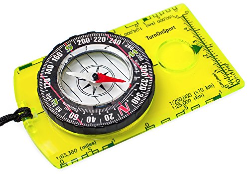
Learn to triangulate your position using two known points. This old-school skill becomes invaluable when fog rolls in or your GPS malfunctions.
Emergency Communication Devices
Stay connected anywhere with the compact Garmin inReach Mini 2. This satellite communicator offers two-way messaging, interactive SOS, and TracBack routing for confident exploration.

VHF radios reach other boaters and emergency services within 15-20 miles on most lakes. Program local emergency channels and marina frequencies before launching.
Stay connected and safe on the water with the Cobra MR HH350 FLT. This 6-watt handheld VHF radio features a noise-canceling mic for clear communication and floats for easy retrieval.

Satellite communicators like SPOT or Garmin inReach send distress signals anywhere. These devices work when cell phones can’t reach towers from remote lake areas.
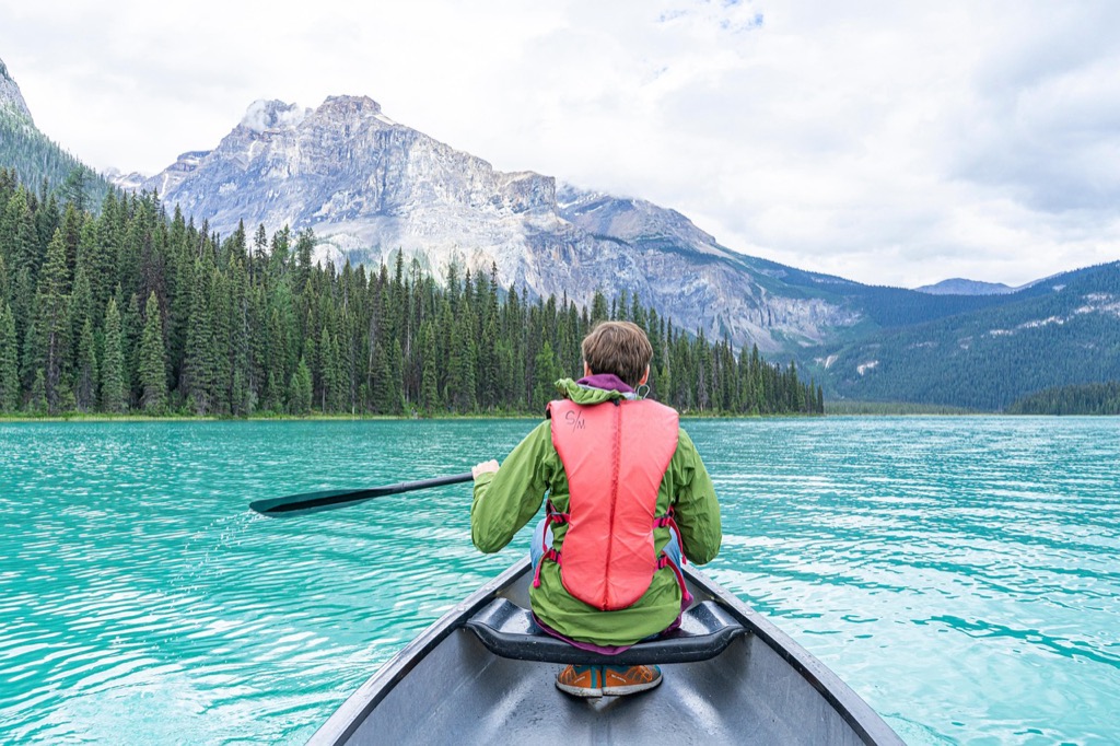
Planning Your Route Before Departure
Route planning separates confident navigators from those who wing it and hope for the best. You’ll avoid hazardous areas and maximize your time on the water when you map your journey before launching.
Pre-Trip Weather Forecasting
Check multiple weather sources 24 hours before departure and again morning-of for the most accurate conditions. Lake weather can shift dramatically within hours, turning calm mornings into afternoon storms with dangerous winds.
Monitor wind speed, direction changes, and precipitation forecasts specifically for your departure and return times. Weather apps often miss localized lake effects that create sudden temperature drops and choppy conditions.
Identifying Safe Harbor Locations
Mark at least three protected coves or marinas along your planned route where you can shelter from sudden weather changes. These safe harbors should offer wind protection from multiple directions and easy water access.
Study your lake charts to identify natural windbreaks like islands, peninsulas, or deep bays with gentle shorelines. Avoid areas with rocky outcroppings or shallow approaches that become dangerous in rough conditions.
Estimating Travel Time and Fuel Requirements
Calculate your travel time based on your boat’s cruising speed, then add 30% extra for headwinds, waves, or detours around hazards. Most recreational boats average 15-25 mph on calm lakes, but conditions can cut that speed significantly.
Plan fuel consumption at 1.5 times your normal rate to account for engine strain from wind resistance and potential route changes. Always carry enough fuel to reach your furthest destination plus return to your launch point with reserves.
Maintaining Proper Speed and Distance
Speed control becomes your most critical safety tool once you’re navigating open water. Your ability to adjust throttle and maintain safe distances determines whether you’ll handle unexpected situations or create dangerous ones.
Speed Adjustment for Visibility Conditions
Reduce your speed by at least 50% when visibility drops below 500 yards. Morning fog and afternoon haze create deceptive conditions where obstacles appear suddenly.
You’ll need to throttle down to displacement speeds (around 5-7 mph) in heavy fog or rain. This gives you enough time to identify and avoid submerged logs, shallow areas, or other vessels before impact occurs.
Safe Following Distance Guidelines
Maintain a minimum 150-foot distance behind other vessels at cruising speeds. This three-second rule gives you adequate reaction time for sudden stops or course changes.
Double this distance when following larger boats that create significant wakes. Their blind spots extend much further than smaller craft, and their stopping distance increases dramatically with size and speed.
Wake Management Around Other Vessels
Slow to no-wake speeds within 100 feet of anchored boats, docks, or swimming areas. Your wake continues traveling long after you’ve passed, potentially causing damage or injury.
Trim your bow down when passing close to shore or other vessels. This reduces wake height and demonstrates courtesy to fellow boaters while protecting shoreline property from erosion.
Recognizing and Responding to Emergency Situations
Lake emergencies develop quickly and demand immediate action. Your ability to recognize warning signs and respond effectively can mean the difference between a minor inconvenience and a life-threatening situation.
Engine Failure Protocols
Immediately secure your position by dropping anchor to prevent drifting into hazards. Check fuel levels, kill switch connections, and battery terminals before attempting restarts. Signal for assistance using VHF radio, horn blasts, or distress flags while maintaining your position. Keep spare parts like fuses, spark plugs, and emergency oars aboard for basic repairs.
Severe Weather Response Procedures
Reduce speed to displacement speeds and head for the nearest safe harbor when wind speeds exceed 15 mph. Monitor weather radio continuously and watch for lightning, dark clouds, or sudden temperature drops. Secure all loose items, lower antennas, and ensure everyone wears life jackets before conditions worsen. Never attempt to outrun storms across open water.
Stay informed with the Midland WR120B NOAA Weather Radio. It provides alerts for over 60 emergencies with S.A.M.E. localized programming and features a selectable alert tone for customized notifications.

Man Overboard Recovery Techniques
Immediately throw a flotation device while maintaining visual contact with the person. Execute a Williamson turn by reversing course 60 degrees, then turning 180 degrees to return on a reciprocal heading. Approach the person with the wind at your back, engine in neutral, and throw a rope rather than pulling them over the side. Practice these maneuvers regularly in calm conditions.
Following Lake-Specific Rules and Regulations
Each lake operates under its own set of rules that can dramatically impact your navigation safety. Understanding these regulations before you launch prevents costly violations and keeps everyone safer on the water.
Navigation Light Requirements
Your navigation lights must match specific lake regulations, which often differ from federal requirements. Most lakes require red and green bow lights plus a white stern light from sunset to sunrise, but some restrict night navigation entirely.
Check local marina bulletins for seasonal lighting requirements, as many lakes modify rules during busy summer months or fishing tournaments.
Right-of-Way Protocol
Powered vessels always yield to sailboats and human-powered craft unless the other vessel is overtaking you. When two powered boats approach head-on, both turn to starboard and pass port-to-port.
Lake-specific protocols often include yielding to emergency vessels, patrol boats, and designated fishing tournament boats during events.
No-Wake Zone Compliance
No-wake zones extend far beyond posted buoys on most lakes, typically covering all areas within 200 feet of docks, swimming areas, and fuel stations. Your wake must be minimal enough that it won’t rock anchored boats.
Many lakes enforce seasonal no-wake hours during early morning and evening when wildlife feeding occurs.
Practicing Defensive Boating Techniques
Defensive boating transforms your mindset from merely avoiding accidents to actively preventing dangerous situations before they develop. This proactive approach becomes especially critical on lakes where conditions change rapidly and escape routes may be limited.
Constant Situational Awareness
Situational awareness means continuously scanning your environment rather than fixating on your destination. You’ll need to monitor weather patterns, other vessel movements, and changing water conditions simultaneously every 10-15 seconds.
Practice the “360-degree sweep” technique by systematically checking blind spots behind your boat and identifying potential hazards before they become immediate threats.
Alcohol and Boating Safety
Alcohol impairs your judgment and reaction time significantly more on water than on land due to sun exposure and engine vibration. Even one drink can reduce your ability to process multiple safety factors effectively.
Designate a sober operator before departure and maintain zero alcohol consumption during navigation. Save celebrations for after you’ve safely docked and secured your vessel.
Regular Equipment Maintenance Checks
Equipment failure often occurs at the worst possible moment when you’re far from shore or in challenging conditions. Inspect your engine, steering, and safety equipment before every trip rather than waiting for seasonal maintenance.
Check fuel lines, battery connections, and bilge pump operation weekly during boating season. Replace worn components immediately rather than risking failure during critical navigation situations.
Conclusion
Lake navigation demands respect preparation and continuous vigilance. You’ll find that combining these seven techniques creates a comprehensive safety approach that transforms potentially dangerous situations into manageable challenges.
Your success on the water depends on treating each outing as a learning opportunity. Weather conditions equipment performance and water hazards change constantly so staying adaptable keeps you ahead of potential problems.
Remember that even experienced boaters face unexpected situations. The techniques you’ve learned here serve as your foundation but practical experience will sharpen your decision-making skills over time.
Safe navigation isn’t just about following rules—it’s about developing the judgment to make smart choices when conditions don’t go according to plan. Your preparation today determines whether tomorrow’s lake adventure becomes a great memory or a cautionary tale.
Frequently Asked Questions
Why is lake navigation considered more challenging than it appears?
Lake navigation presents hidden dangers that aren’t immediately visible, including shallow areas, submerged obstacles like rocks and fallen trees, and rapidly changing weather conditions. What appears as calm water can conceal significant hazards, especially near shorelines and islands where water depth can change dramatically and debris commonly accumulates beneath the surface.
What essential navigation equipment should every boater carry?
Every boater should have a GPS unit or chart plotter with offline maps, a magnetic compass as backup, and emergency communication devices like VHF radios or satellite communicators. Download offline maps before departure, set waypoints for key locations, and ensure all electronic devices are fully charged with backup power sources available.
How should I plan my route before departure?
Check multiple weather sources for accurate forecasts, identify safe harbor locations along your route for emergency shelter, and estimate travel time accounting for potential delays. Plan fuel requirements with extra reserves, mark hazardous areas on your chart, and share your planned route with someone onshore for safety.
What speed should I maintain in poor visibility conditions?
Reduce speed by at least 50% when visibility drops below 500 yards. In heavy fog or rain, throttle down to displacement speeds (5-7 mph) to allow adequate time to identify and avoid hazards. Always maintain speeds that allow you to stop within half your visible range.
How much following distance should I maintain behind other vessels?
Maintain a minimum of 150 feet behind other vessels at cruising speeds, and double that distance when following larger boats. In congested areas or poor visibility, increase following distance further. This provides adequate reaction time to avoid collisions and navigate around stopped or turning vessels safely.
What should I do if my engine fails on the lake?
Immediately drop anchor to secure your position and prevent drifting into hazards. Signal for assistance using VHF radio, visual distress signals, or satellite communicator. If in a shipping channel or high-traffic area, try to move to safer water using paddles or by calling for an immediate tow.
How do I perform a man overboard recovery?
Maintain constant visual contact with the person in water and immediately execute a Williamson turn (hard turn away from the person, then reverse course). Approach from downwind at slow speed, keeping the person on your port side. Throw flotation devices while maneuvering and have crew ready to assist with recovery.
What are the key lake-specific regulations I need to follow?
Navigation light requirements vary by lake size and location, with specific rules for right-of-way between different vessel types. No-wake zones often extend beyond posted buoys, especially near docks, swimming areas, and environmentally sensitive regions. Always check local regulations before launching, as violations can result in significant fines.
How can I practice defensive boating techniques?
Maintain constant situational awareness using a “360-degree sweep” technique every few minutes to monitor your surroundings. Never consume alcohol before or during navigation, as it significantly impairs judgment and reaction time. Keep a safe distance from other vessels and always assume other boaters may make unpredictable moves.
How often should I check my navigation equipment?
Inspect all navigation and safety equipment before every trip, including GPS units, radios, flares, and backup power sources. Perform monthly detailed maintenance checks on critical systems and replace worn components immediately. Keep equipment manuals accessible and ensure all crew members know how to operate essential safety devices.